Docs Build
Importing locations
Bring your locations in from a spreadsheet, an XML feed or a Google Sheet, and check where they landed before anything is saved.
Before you start
#Your file needs one row per location. Every row needs a name and something to place it with — a street address, a town, a postcode, or latitude and longitude. Phone, website, description, tags and a pin colour are optional, now or later.
Nothing is saved until you press Import on the last step. Until then you can go back or close the tab.
Files we can read
#| Format | Notes |
|---|---|
| CSV | Files ending .csv, .tsv or .txt. Commas, semicolons and tabs all work — we work out which one your file uses. |
| Excel | Files ending .xlsx or .xlsm. If the workbook has several sheets, you pick the one to use. |
| XML | Files ending .xml or .kml. We find the repeating record in the file ourselves, so there is no schema to match. |
| Google Sheets | Paste a link instead of downloading anything. The sheet has to be readable by anyone with the link. |
We cannot read .xls, .numbers or .ods. Open the file in Excel or Numbers and save it again as .xlsx or CSV.
GeoJSON and TopoJSON files hold areas and lines, not locations — use Import shapes in the map editor for those.
Getting your columns ready
#No renaming needed. We read each column’s name and its values, in English, German, French, Spanish, Italian, Dutch and Polish. Columns called Column1 to Column9 still import — we go by the values.
These are the fields a column can be mapped to:
| Field | What it holds |
|---|---|
| Name | What the location is called. The only field every row must have. |
| Street address | The street and number. Joined with the four fields below into one address. |
| City | Town or city. |
| Postcode | Postal or ZIP code. |
| State or region | County, state, province or region. |
| Country | Country name or code. |
| Latitude | Between -90 and 90. Has to be mapped together with Longitude. |
| Longitude | Between -180 and 180. |
| Latitude and longitude together | One column holding both, like 52.5200, 13.4050 — or a map link. |
| Main tag | One per row. It goes first, which is what colours the pin on the map unless the row has its own Pin colour. |
| Tags | Extra filters for your visitors. One column, several tags per row, separated by a comma, a semicolon or a pipe. |
| Description | A sentence or two shown on the location’s card. |
| Phone | Shown on the card as a number people can tap. |
| Shown on the card. Anything that is not an email is left out. | |
| Website | Shown on the card. Anything that is not a web address is left out. |
| Pin colour | Optional styling. A colour code like #e03131 that colours this location’s pin and its card. |
The five address fields are joined, in the order above, into one address, so addresses can be spread across several columns. Each column feeds one field only.
Styling locations with a colour
#Add a column with a colour code for each row, for example #e03131. We recognise columns called Colour, Color, Pin colour, Marker color or Hex, or any column whose values are colour codes. The colour is used for:
- the location’s pin on the map,
- the Button on its card, unless you gave the Button its own colour,
- the pin drawn by the card’s Logo block.
Leave a cell empty and that location keeps its usual colour from its main tag or your map’s theme. Write codes as #rrggbb, rrggbb or #rgb. Colour names such as red are not read: the row is flagged on the Review step and keeps its usual colour. An uploaded logo image keeps its own colours.
Step 1 — Source
#Open the wizard
Go to Locations in your map and press Import locations.
Upload a file, or point us at a sheet
On Upload a file, press Choose file or drag the file onto the page. It is read in your browser, not uploaded.
On Google Sheet, paste the link into Google Sheets link and press Read sheet. Share the sheet first: Share → General access → Anyone with the link → Viewer.
Pick a sheet, if there are several
A workbook with more than one sheet shows a Sheet picker. Changing it re-reads the file you already chose.
Step 2 — Columns
#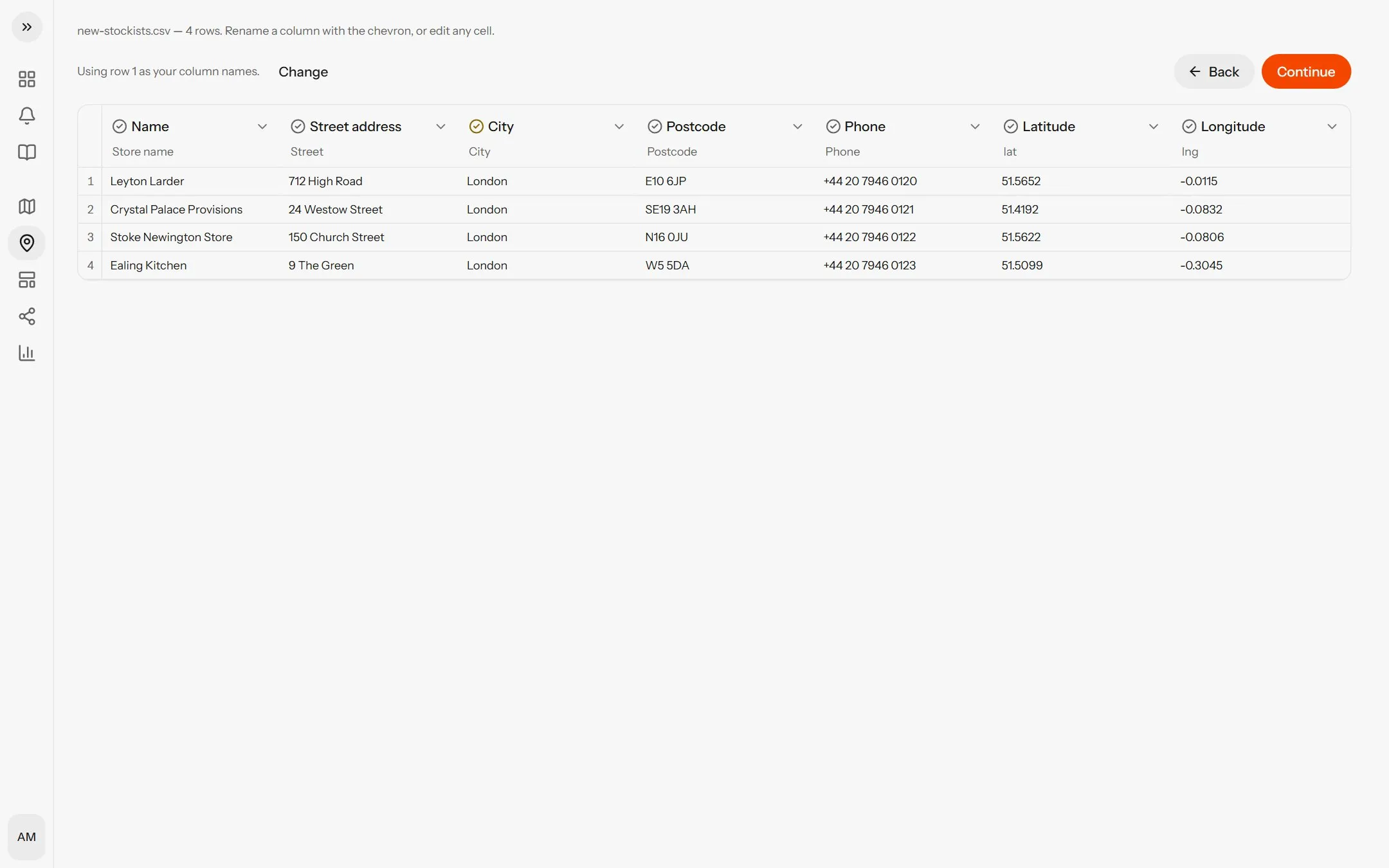
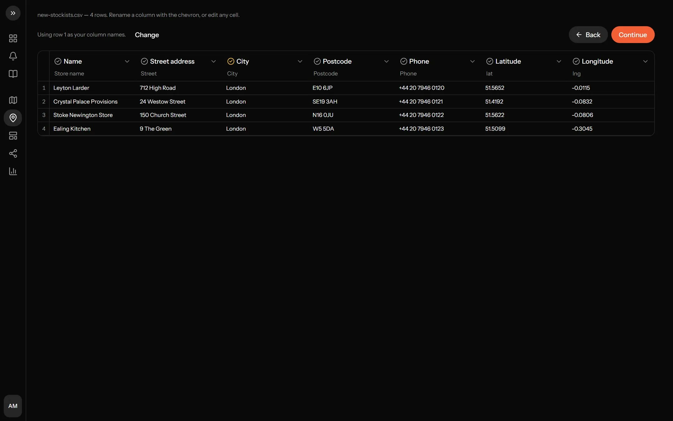
Your file is shown as a table, with our reading of each column above it. Correct anything we got wrong.
Check the header row
Exports often start with a title or a blank line, so the step says Using row N as your column names, or No header row found — we named the columns ourselves. If it picked the wrong one, press Change.
Check each column
Each column is marked Detected, Likely, Guessed or No match. Open its picker to change it: fields that fit come first under Likely for this column, and Don’t import leaves it out. Edit any cell in place, and rename a column from the chevron beside its name.
Clear anything we flag
A banner, One thing to sort out, lists what is missing — usually a name or an address column.
Press Continue
Continue is above the table, and works once the flagged problems are cleared.
These columns look swapped means your latitude column holds values past 90, which only a longitude can. Press Swap them, or every location lands in the wrong place.
If one column holds both coordinates, press Split into Latitude and Longitude.
Step 3 — Addresses
#Addresses are looked up once, here. Rows with latitude and longitude are skipped, and identical addresses share one lookup, so lookups are usually fewer than rows.
The progress bar reads N of M addresses. Skip the rest stops and keeps what was found; place the rest by hand on the next step.
A long import survives a reload: the wizard picks up where it stopped. To throw the run away, press Back on the columns step.
Step 4 — Review
#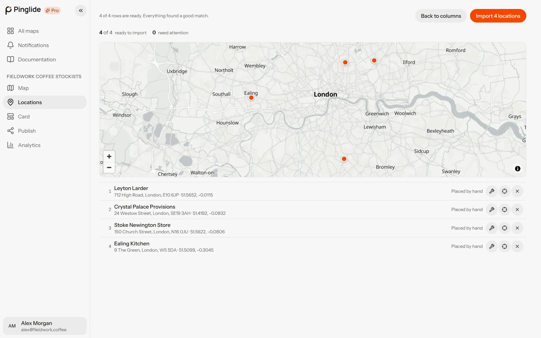
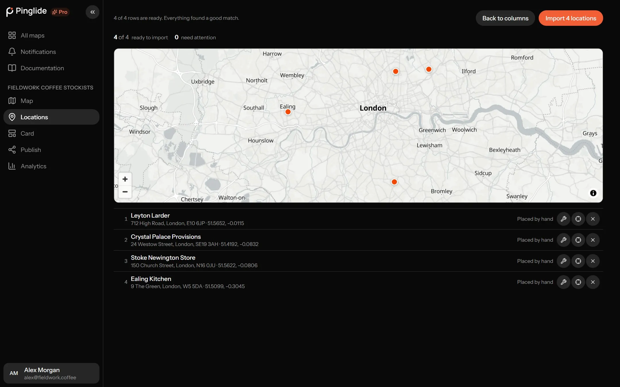
A map above your rows, and still nothing saved. The header says N of M rows are ready, with tallies for ready, need attention and not placed. Show only rows that need attention starts on.
For any row that needs work:
- Drag its pin on the map — fastest for the right street but the wrong building.
- Press the wrench beside a row (Fix row) to edit the address and search again, or to pick one of the other matches we found. The tick (Done with row) closes it.
- Press Place on map for a row that was never found, then click where it belongs.
- Leave a row out entirely by clearing its name on Back to columns.
What each status means
#| Status | What it means |
|---|---|
| Good match | We found the address confidently. Nothing to do. |
| Rough match | Found, but only as far as a street or a town. Check the pin — drag it, or pick another match. It imports either way. |
| No match found | We searched and nothing came back. Edit the address and search again, or place the pin yourself. It cannot import until you do. |
| Placed by hand | The coordinates came from your file, or you placed the pin. We never look these up. |
| Not looked up | The search never ran, usually because it was skipped. Search it, or place the pin. |
Red rows can’t import until fixed or removed. Amber rows import as they are.
Importing
#Press Import N locations. Tag columns become tags, the main tag goes first so it colours the pin, a Pin colour column colours its row’s pin and card instead, and you land back on your map.
From a Google Sheet on Starter or Pro, the Review step also offers Keep in sync with the sheet — see Google Sheets sync.
A map holds up to 25 locations on Free, 300 on Starter and 3,000 on Pro. The wizard checks the room left before writing anything, so an import over the limit is stopped rather than half applied.
Fixing locations later
#On the Locations page, Show → Needs attention lists every location we are unsure about; the same menu offers Not placed, Rough match, Approximate address and Missing details. Open one to search its address again, or drag its pin in the map editor.
When something goes wrong
#| What you see | What to do |
|---|---|
| The file is too big | Files must be under 5MB. Split it and import the parts in turn — they add up. |
| Only some rows arrived | One file imports at most 3,000 rows. Split it, or check your plan’s limit. |
| Your plan is full | Remove some locations, or move to a larger plan. |
| That’s an older .xls file | Open it in Excel and save it again as .xlsx or CSV. |
| The Google Sheet won’t read | Share → General access → Anyone with the link → Viewer. A sheet shared only with named people cannot be read. |
| Every pin is in the wrong country | Latitude and longitude are almost certainly swapped. Go back to Columns and press Swap them. |
| Rows that repeated your column names were dropped | Normal for exports that stack several tables in one file. The count says how many. |
| A website or email is missing | It couldn’t be read as one, so it was left out and the rest of the row imported. |