Docs Build
Shapes and routes
Draw delivery areas, zones and lines on your map, import them from a GIS file, and draw driving routes between locations.
The drawing tools
#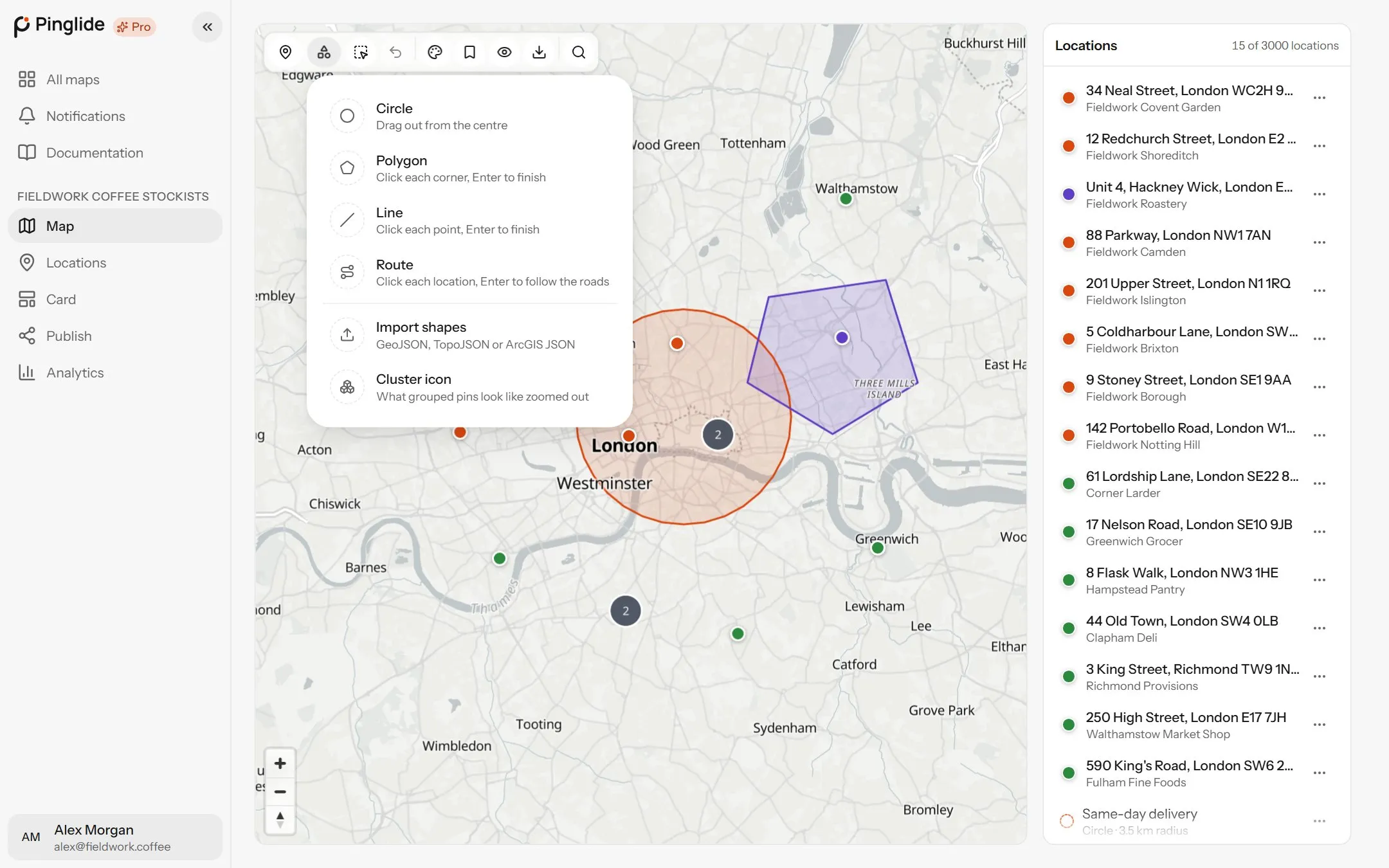
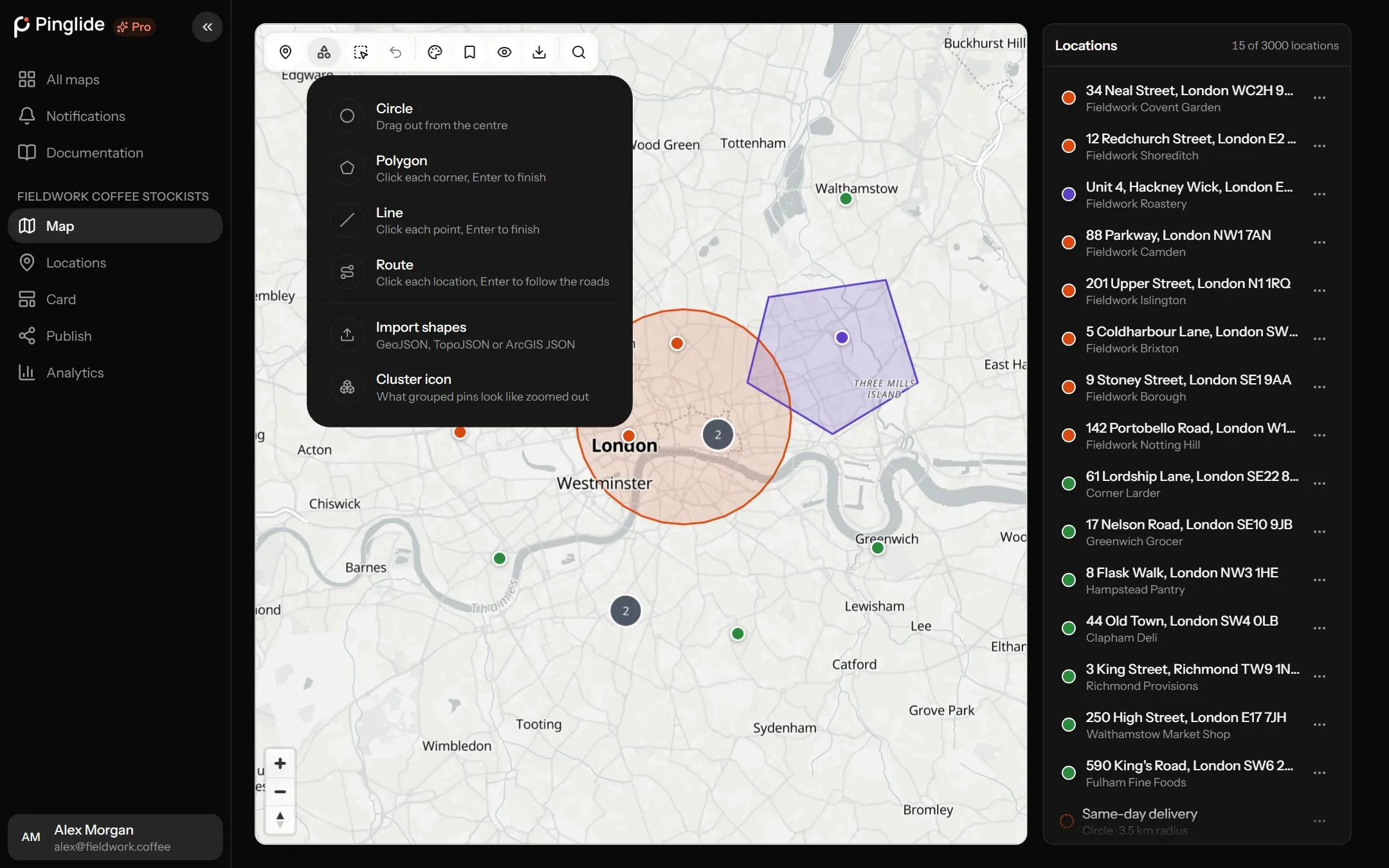
On the Map tab, press the shapes button, second from the left in the toolbar:
| Tool | How it draws |
|---|---|
| Circle | Drag out from the centre. |
| Polygon | Click each corner, Enter to finish. |
| Line | Click each point, Enter to finish. |
| Route | Click each location, Enter to follow the roads. Starter and Pro. |
| Import shapes | GeoJSON, TopoJSON or ArcGIS JSON. |
Esc puts a tool away; Backspace removes the last point placed.
Drawing a shape
#Circle
Press at the centre and drag outwards. The smallest radius is 10 metres.
Polygon
Click each corner, then the first point again or Enter to close it.
Line
Click each point, then Enter. A point near a location snaps onto it.
New shapes are named Circle 1, Area 1 or Line 1, ready to rename.
Changing a shape
#Click a shape to select it. On the map, drag a circle’s handles to move or resize it; drag a polygon’s points to reshape it, its centre to move it, or the handle mid-edge to add a point. Changes save when you let go. For its details, press Edit shape:
| Setting | What it does |
|---|---|
| Name | What the shape is called on its card. |
| Description | A line or two shown on its card. |
| Colour | Its outline and fill colour. |
| Thickness | The outline, from 1 to 12 pixels. |
| Line style | Solid, Dashed or Dotted. |
| Fill | How strongly the inside is filled, 0–100%. Not on lines. |
To delete a shape, choose Delete from its menu in the list, then Delete shape. Visitors see it until you publish again.
A map holds 3 shapes on Free, 50 on Starter and 250 on Pro, routes included. At the limit the drawing tools turn grey.
Importing shapes
#Choose the file
Pick Import shapes, then Choose file or drag in a GeoJSON, TopoJSON or ArcGIS JSON file under 5MB. Nothing is saved until you confirm.
Check what was found
The dialog counts the shapes found. If the coordinates could be either way round, use Latitude is written first.
Import
Press Import N.
| What you see | What to do |
|---|---|
| The file isn’t valid JSON | Export it again from your GIS tool. |
| The file has points and no areas or lines | Points are locations. Import them from the Locations tab — see Importing locations. |
| Those coordinates aren’t latitude and longitude | Re-export it as WGS84 (EPSG:4326). |
| The file is over 5MB | Simplify it in your GIS tool. |
| A shape was simplified | Shapes over 500 points are simplified to fit. |
Drawing a route
#A route is a driving line between your locations along the roads, with its distance and drive time. Starter and Pro only.
Choose Route
Pick Route. Locations no road reaches turn grey and can’t be picked.
Click the stops in order
Click the starting location, then each one after it — up to 25 stops. Only locations can be stops.
Press Enter
The route is drawn along the roads. Its card reads like Route · 12 km · 19 min.
Routes are a line and a time, not turn-by-turn directions — for those, a card’s Directions link opens the visitor’s maps app.
Opening the Route tool uses up to one lookup per location on the map, from your monthly allowance. See What counts as a lookup.
Changing a route
#A route’s stops are listed under it in the Map tab’s sidebar, each with a menu: Move up, Move down, Make this the start, Make this the end and Remove from route.
Move a stop’s location and the route keeps its old line until you press Recalculate.
Edit shape sets a route’s Line style and Colour. In a coloured group, its stops take that colour too.
When a route won’t draw
#| What you see | What to do |
|---|---|
| {name} can’t be a stop | No road is near it. Move its pin closer to a road, or pick another location. |
| Click a location to add a stop | You clicked open ground. Click a pin instead. |
| That location is still saving | Wait a second, then click it again. |
| No route between those stops | No drivable way between them — an island, say. Move a stop nearer a road. |
| Couldn’t work out the route | The routing service was busy. Press Enter again in a moment. |
| Routes aren’t included on the free plan | Routes are on Starter and Pro — see Plans and billing. |