Docs Publish
Publishing and embedding
Design how your published map behaves, publish it, and paste one line of code into your website.
The Publish tab
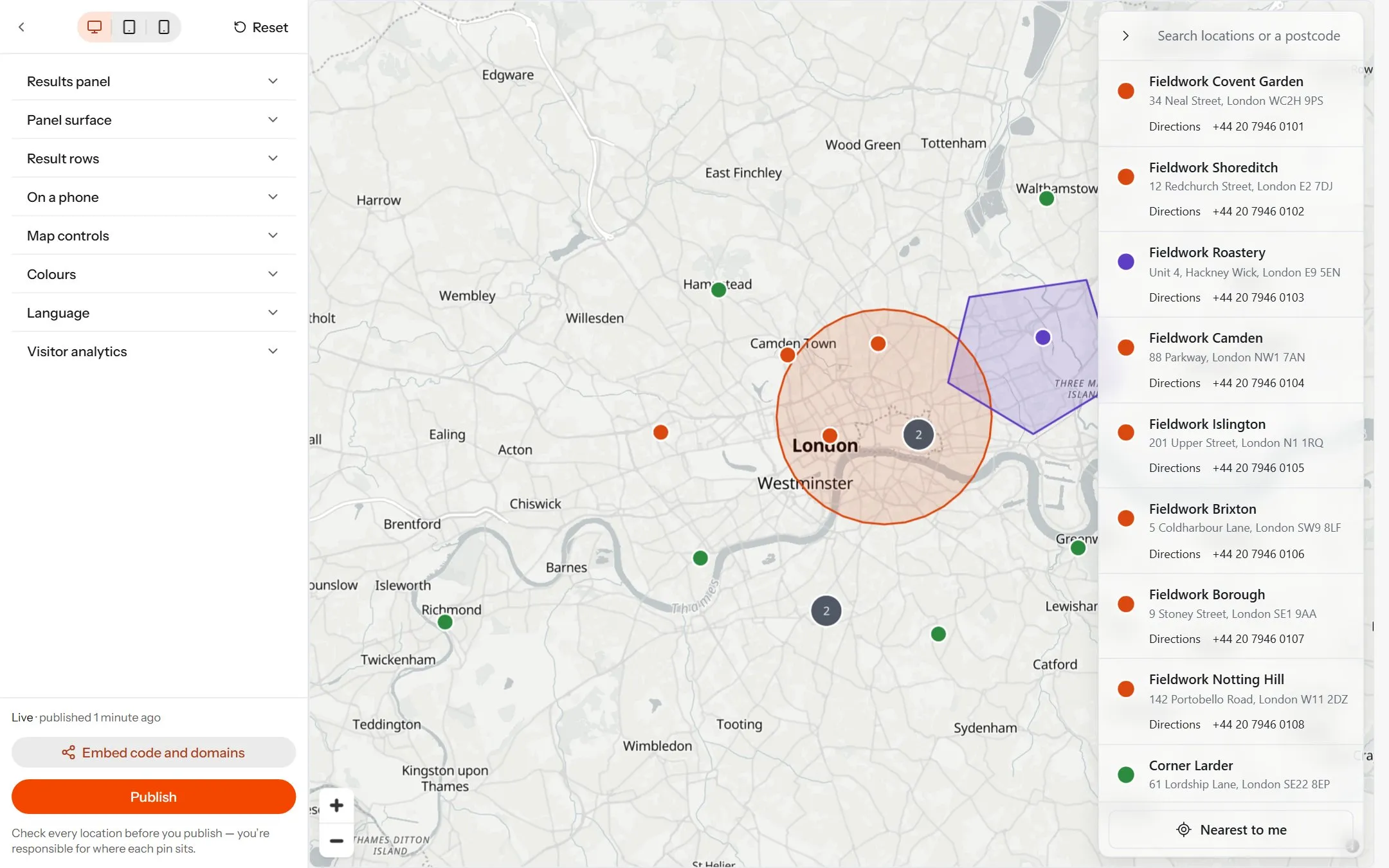
#Open Publish in your map’s sidebar: design settings on the left, a live preview of the published map beside them. On a phone the settings open from a Design sheet at the bottom.
Desktop, Tablet and Phone change the preview’s width only. Reset puts every design setting back to its default.
Design changes save as you make them, and reach your website when you press Publish. Until then visitors see the last version you published.
Designing the published map
#
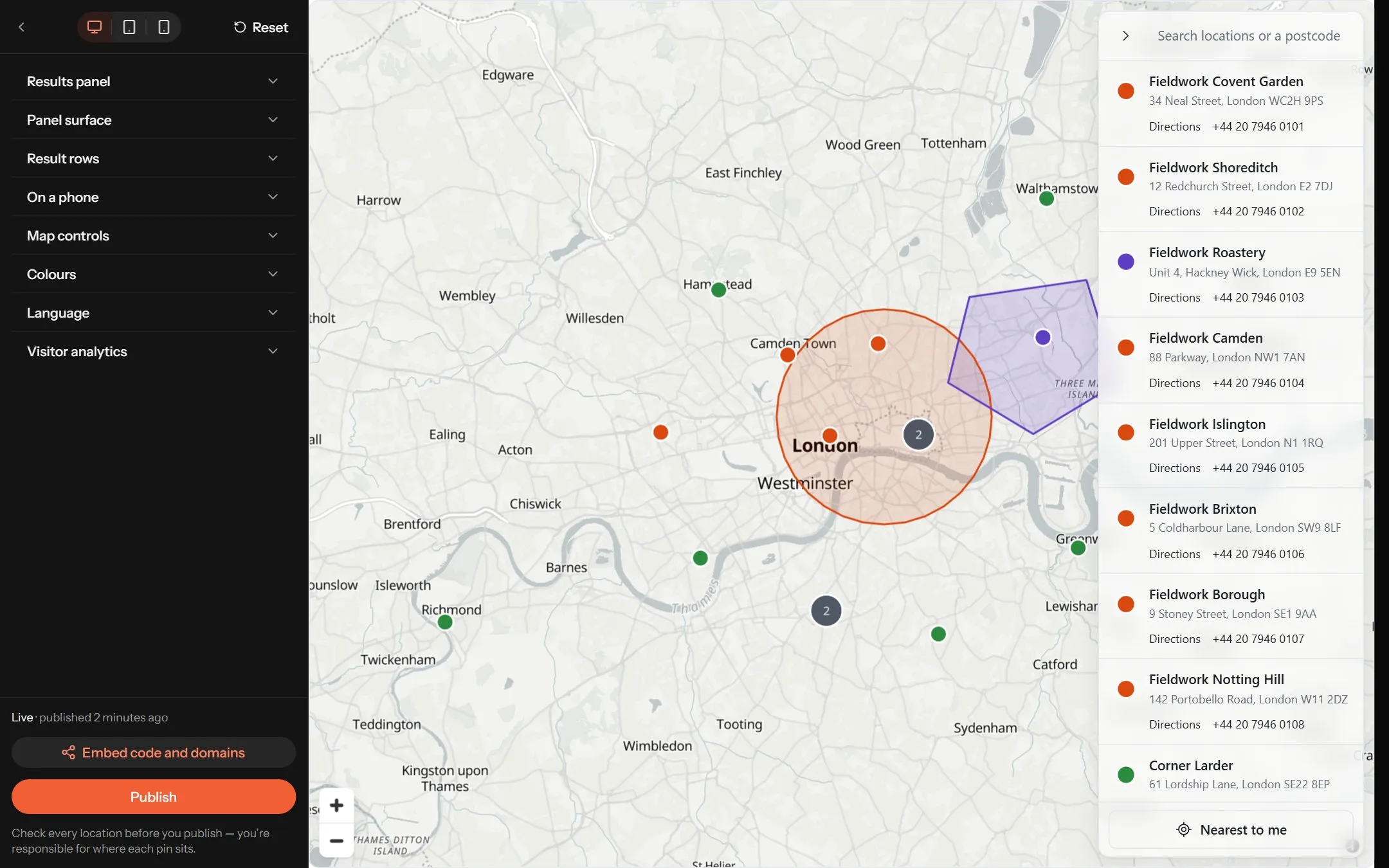
The settings come in sections that open one at a time.
| Section | What it controls |
|---|---|
| Results panel | Show the results panel — the list over the map — with its Side and Width, and whether a row opens its card. |
| Panel surface | The panel’s Transparency, Blur behind and Corners. |
| Result rows | What each row shows — Pin, Address, Distance, and Directions and phone links — and the Pin size. |
| Map controls | The Corner the zoom buttons sit in. The Search box and Nearest to me. Zoom with the scroll wheel, Group nearby pins, Open a card when a pin is clicked, and Ripple published pins. |
| Colours | Panel, Text, Secondary text, Lines and Accent, and the Default pin colour for locations nothing else colours. |
| Language | English, Lietuvių, Deutsch, Français or Español, and Edit wording to change any phrase. |
| Visitor analytics | Measure how visitors use this map. See Visitor analytics. |
Zoom with the scroll wheel starts off, so visitors scroll past the map rather than getting stuck zooming it. Group nearby pins starts on.
Publishing
#Press Publish at the foot of the settings. The toast reads Published with the number of locations now live, and names any left out for having no usable position. The line above the button says where things stand:
- Not published yet — nothing is live.
- Live · published 3 days ago — your site shows the map as it was then.
- you’ve made changes since — publish again to push them — edits to locations, shapes, the card or the design are waiting.
Putting the map on your site
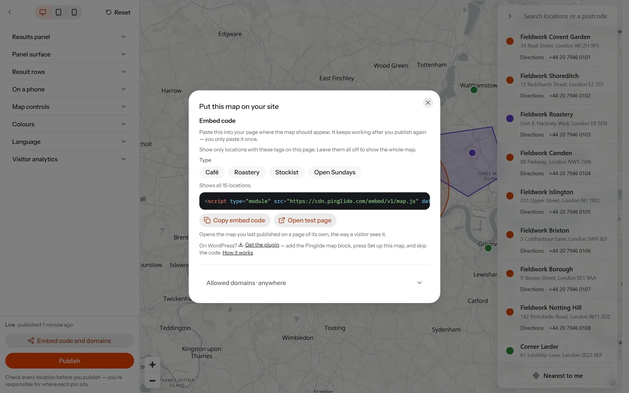
#
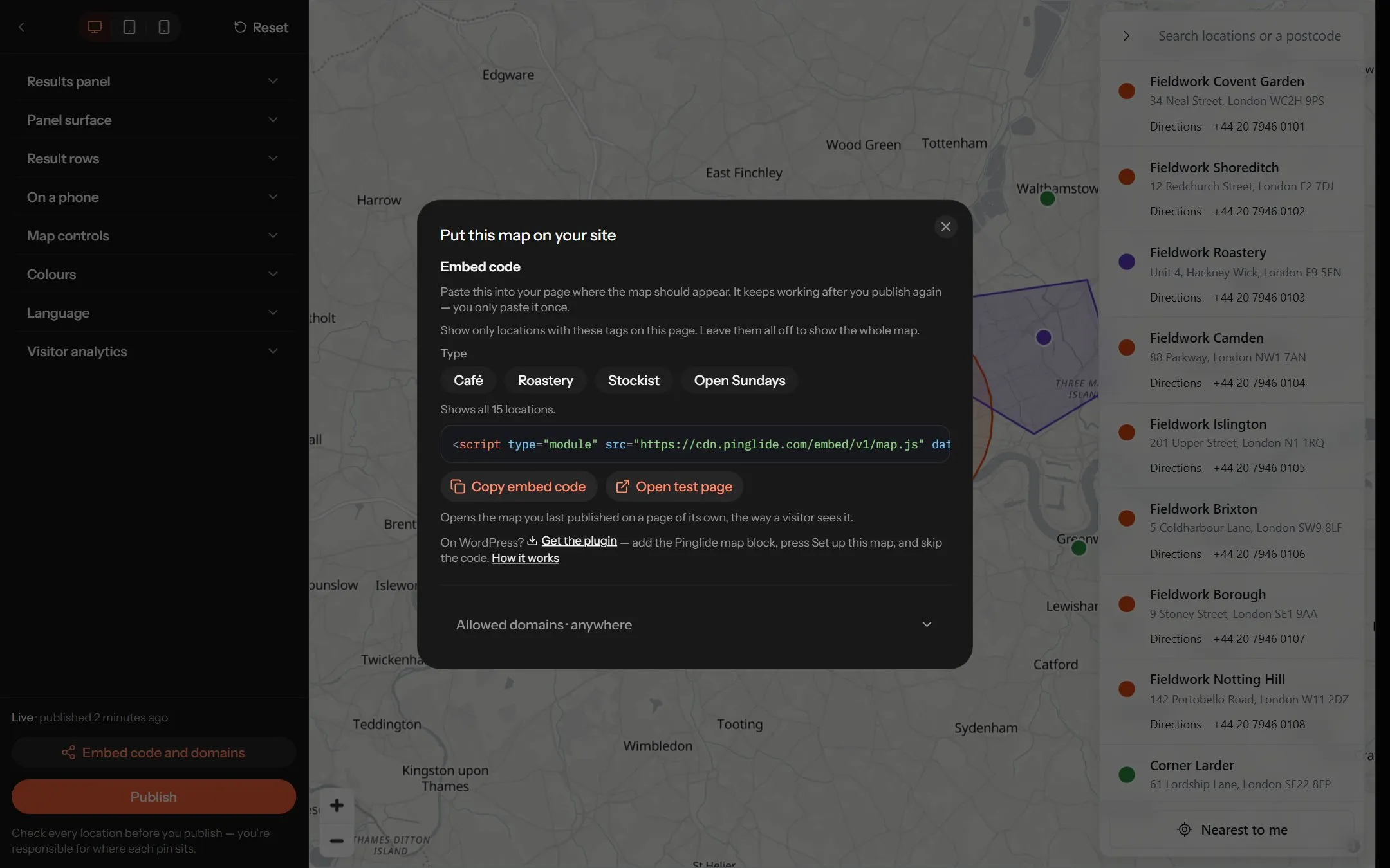
Copy the embed code
Press Get embed code, then Copy embed code. The code appears after your first publish.
Add an HTML block to your page
Where the map should appear, add your website builder’s block for your own code — usually Embed, Custom code, Code or HTML.
Paste and save
Paste the line in and publish your page.
You paste it once. The code always shows your latest publish.
On WordPress there is nothing to paste — the WordPress tab in the same window has the plugin, and Maps for WordPress has the details.
The code is one <script> tag. These attributes change how the map is placed:
| Attribute | What it does |
|---|---|
data-height | The map’s height in pixels. 520 to begin with; the smallest is 160. |
data-target | A CSS selector to draw the map into, when the script can’t sit where the map goes. |
data-eager | Loads the map at once. Without it, the map loads as a visitor scrolls near it. |
data-tags | Shows only locations with these tags. Pick them under Show in the Embed code window — the code uses tag ids. |
To open the map on one location, add ?place= and the location’s id to your page’s address. Open test page shows your last publish on a page of its own, as a visitor sees it.
Sending map activity to your own analytics
#Everything a visitor does on the map — opening a location, Directions, searching, Nearest to me — fires a pinglide event on your page, on every plan. Nothing is sent anywhere unless you send it. To pass them to Google Analytics, add this below the embed code:
<script>
  document.addEventListener("pinglide", function (event) {
    gtag("event", "map_" + event.detail.type, event.detail);
  });
</script>
event.detail.type says what happened (open, directions, search, nearest…) and event.detail.map which map.
Allowed domains
#Under Allowed domains, list the websites your map may appear on, one per line, and press Save changes. Empty allows anywhere. On any other site the map doesn’t appear — include your staging or preview site too.
- Up to 20 domains; commas work as separators too.
- Subdomains are included:
example.comcoverswww.example.com. - A full address is trimmed to its domain.
This discourages copying, but isn’t security — the published map is a public file. Don’t publish anything you wouldn’t put on your website.
What your visitors can do
#| Feature | How it works |
|---|---|
| Search | Filters the list as they type. Picking a town or postcode from the suggestions measures distances from there. |
| Nearest to me | Uses the browser’s location, sorts by distance and opens the closest. |
| Grouped pins | Nearby pins merge into a bubble with a count. Clicking one zooms in. |
| Cards | A pin opens the card you designed, with Directions to their own maps app. |
| Results list | Up to 100 rows at a time, with a prompt to search when there are more. |
| On a phone | The list becomes a drawer that visitors pull up from the bottom. |
Every map credits OpenStreetMap and the map provider in a corner; that can’t be switched off. Free maps also show a small Made with Pinglide link — see Plans and billing.
When the map doesn’t show
#| What you see | What to do |
|---|---|
| Nothing where the map should be | Check the domain is under Allowed domains, or empty the list. Then check the block still holds the script — some builders strip code from text blocks. |
| An old version of the map | Press Publish again. |
| A location is missing | It had no usable position. Place it on the Locations tab, then publish. |
| Nearest to me says location is off | The visitor blocked location for your site in their browser, and can allow it there. |